Copernicus is a satellite monitoring service that provides updated satellite maps of the earth. It is an initiative created by the European Space Agency (ESA) which plans to achieve by 2021 the ability to obtain updated satellite information on safety and the environment.
The benefits of using Copernicus
Copernicus is an open source program and the data is freely accessible to anyone who requests it. What are the advantages compared to other satellite services such as Google Earth?
The peculiar feature of Copernicus is the ability to access updated satellite maps of any area of the earth. The satellite images are showed in real time or almost, especially when compared to the satellite images of other services, which show images that are several months older.
Copernicus satellite images are updated every 5 days, which would be the time needed for the satellite to go around the earth and return to the same point. How do you view updated satellite images obtained through the Copernicus program?
If you thought to open the browser, write your home address and zoom with the mouse wheel, you are a little out of the way. But there is no need to be discouraged, after all, it is nothing so difficult.
How to use Copernicus Open Access Hub
First you need to visit the Copernicus Open Access Hub page and register, once the operation is complete you will be able to login (1).
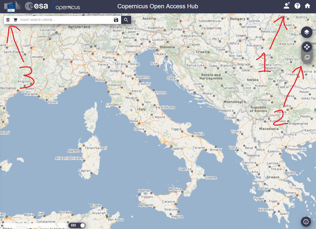
Now we can use the mouse wheel to enlarge the area of our interest. In order to delimit the area for which we will ask to obtain updated satellite images, we must use the appropriate tool at the top right (2).
We can now access the settings that will allow us to select the period of exposure, the type of platform and other settings related to the satellites (3).
The sentinel missions
As we can see from the drop-down menu, we can select three missions and we can refer to three different “sentinels”:
The “sentinel-1” mission started on 03 April 2014, bringing a C-band synthetic aperture radar into orbit. This tool provides updated satellite maps for monitoring the Arctic environment, the marine one, as well as mapping land surfaces.
The launch of the “sentinel-2” mission was made on 23 June 2015 to monitor the state of the green areas of the planet. The satellites acquire multispectral satellite images in 13 bands, from visible to infrared. This means that the sensors of the “sentinel-2” are the most suitable ones to show Google-style images, even if with less details.
The “sentinel-3” was sent into orbit on February 16, 2016 with the mission of measuring the topography of the marine surface. It also measure the temperatures of earth and sea surface for the purposes of climate and environmental monitoring.
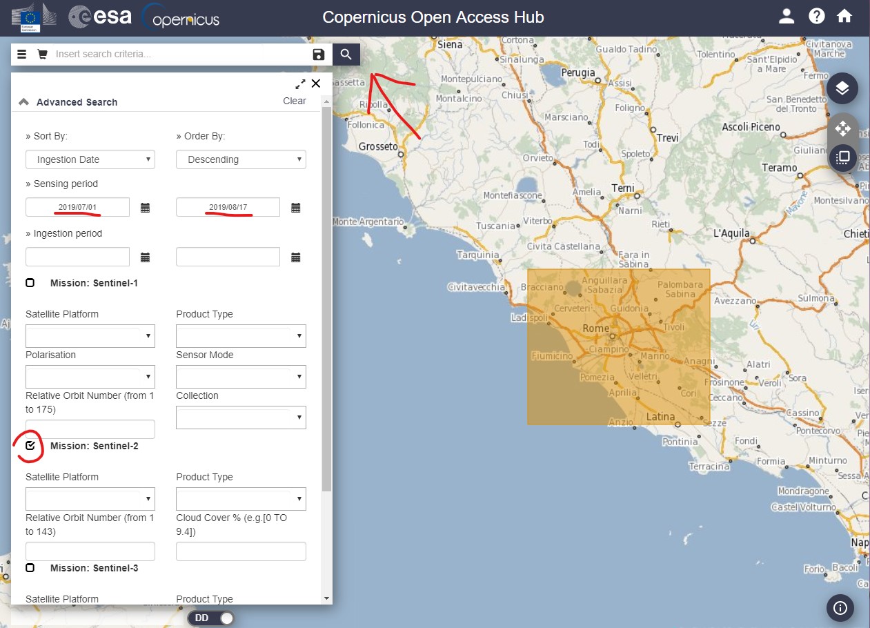
If we leave all the fields blank, the system will respond with all the available data in reference to the area we have previously selected. For the first attempts, I advise you to select only the sentinel-2 item and to indicate a limited period of time like a few months, as shown in the previous image.
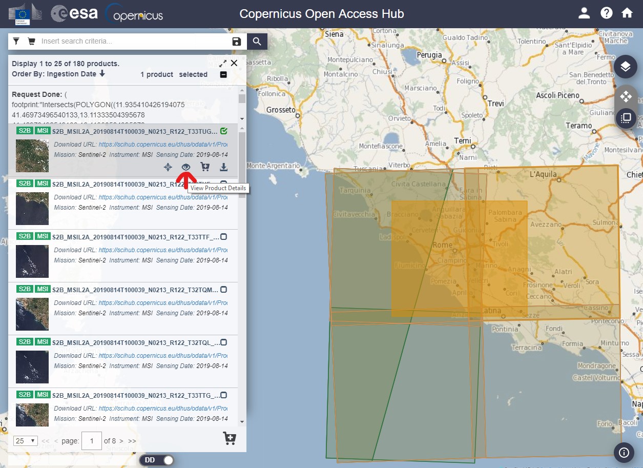
Once clicked on the search button, the system will show a list of datas related to the updated satellite images requested.
Download updated satellite maps
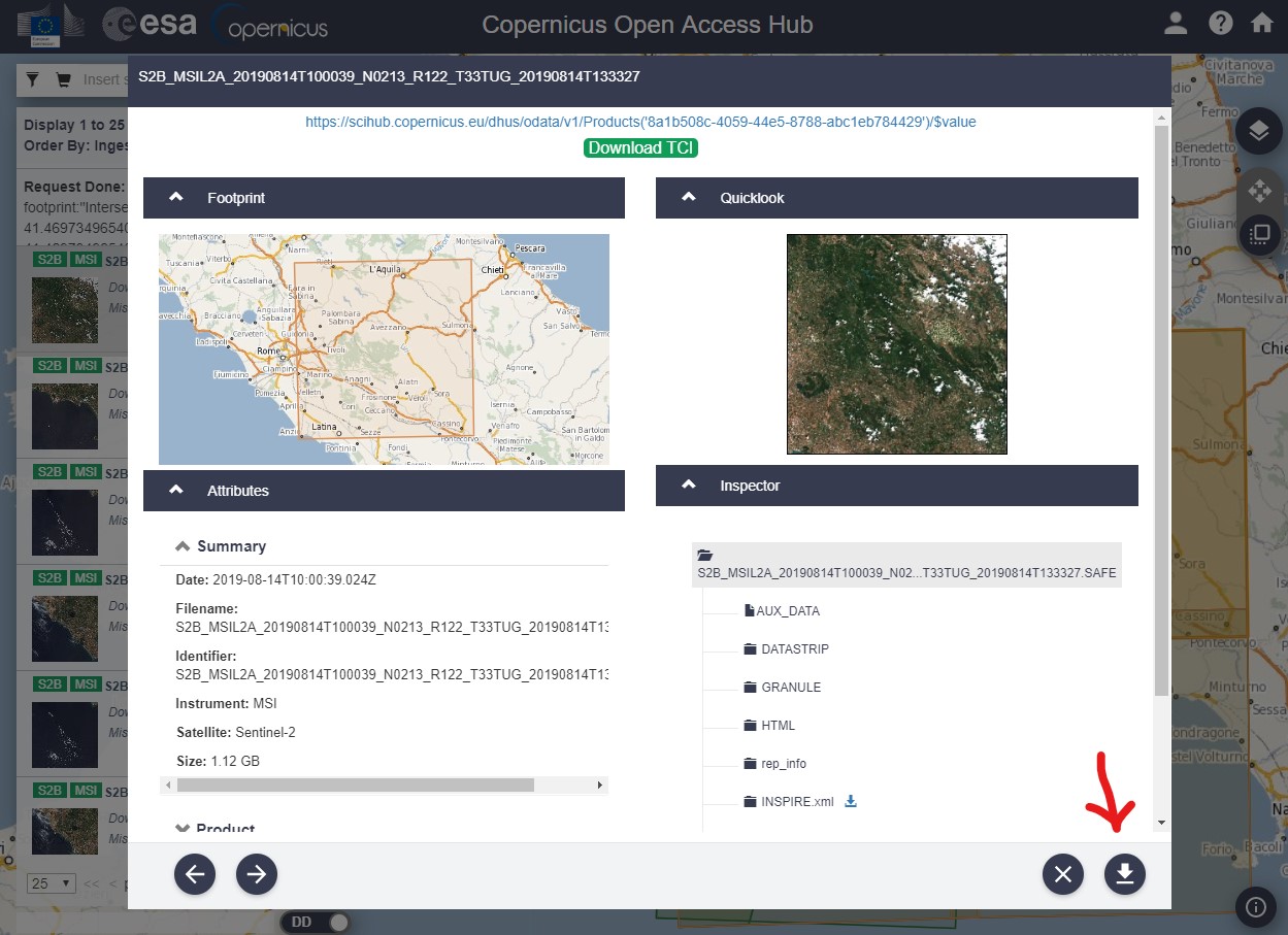
At this point, by clicking on the icon showed in the previous image, we can access the details of the datas related to the updated satellite images that we have selected before. If they are the right datas, we just have to click on the download button and start downloading the files. The images can be quite heavy, depending on the area and the selected period.
Once downloaded and unpacked the files, we will realize that they are not simple images in jpg format, but a series of folders that contain different files. In order to open them easily, we will need to download a particular software provided by the European Space Agency itself. To find out how to download and use this software, I invite you to read “Viewing Copernicus xml satellite images with SNAP“.
2 commenti su “Updated satellite maps, Copernicus”